February 2021 Update

On Saturday, February 6, We had the opportunity to travel over the Ridge Route and survey the roadway for damage from the storms, trucks, and car chase that have happened all since January 21. The storms that hit were pretty strong, closing I-5 multiple times for extended periods. As the Ridge Route itself is higher in elevation, it looks like a lot of the precipitation that hit the area fell as snow instead of rain. This may well have saved the road this time but future storms may no be so “kind”. We still have a lot of work ahead of us but at least now we have a better idea of what to focus on for now. If you’d like to help us with these tasks, join us, donate, or both. Your donation may be tax-deductible and you’ll help save this historic roadway.

As an aside, our next update may be in a different format as we are planning to move to a newsletter style soon.

Gates

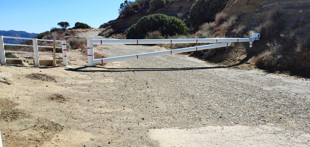
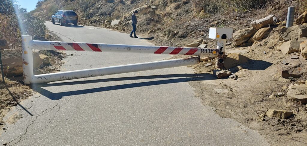
Southern gate
Northern (Fisher Springs or Tumble Inn) gate

Both gates were open when we went up there. We closed them behind us each time and locked them. While we want the roadway open, the current USFS position is for the roadway to be closed and the events of January 26 definitely show why. This time, the gates were left open by contractors working on the SCE power lines a few miles north of the National Forest Inn site. We will be speaking again with the USFS to see what can be done about this problem.

Rockslides

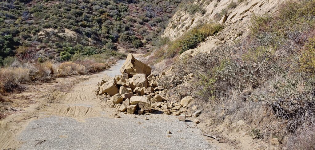
Rockslide partially blocking the roadway below Swede’s Cut
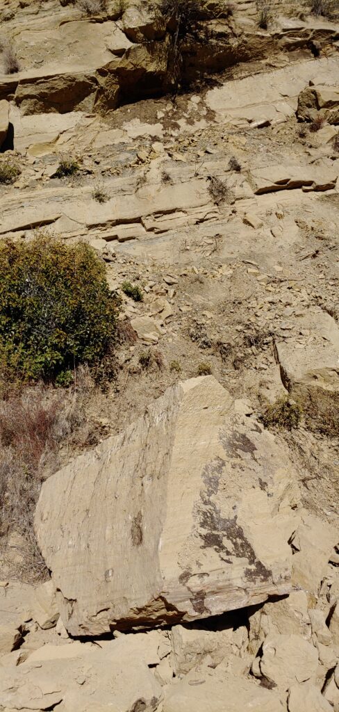
Large boulder and additional material ready to fall

Our biggest concern following the storms was rockslides or worse, landslides. Thankfully, the roadway seemed to hold up well. Only one major rockslide was found, which was located on Serpentine Drive just north of the gas pipeline bridge. One of the rocks that fell was the rather large, close to the size of a refrigerator and probably as heavy. We saw that more rocks will fall at this location in the near future. Other problematic locations, such as Swede’s Cut and the northern end of the roadway, seemed to have minimal problems.

Truck Damage
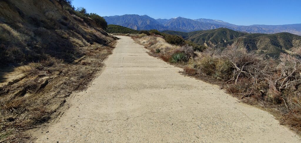
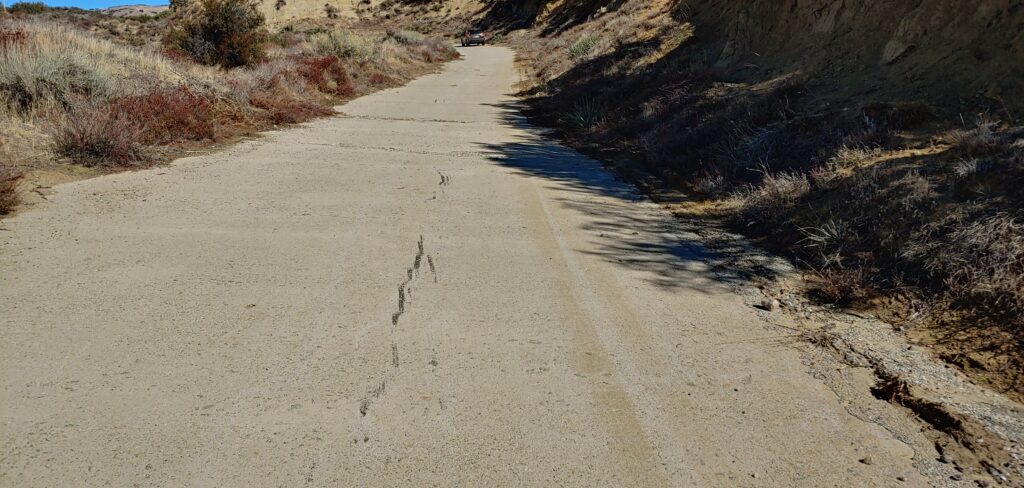
Tire marks and trampled shoulder
First big sign of skid marks and scrapes
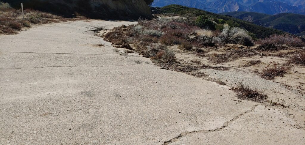
Looking southerly toward the sunken area where they got stuck
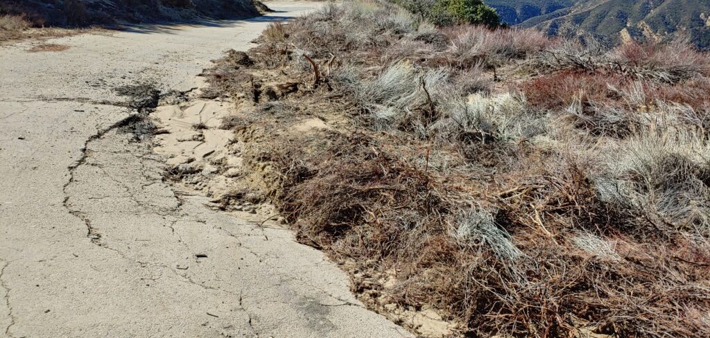
Closeup of the broken pavement and tire debris area
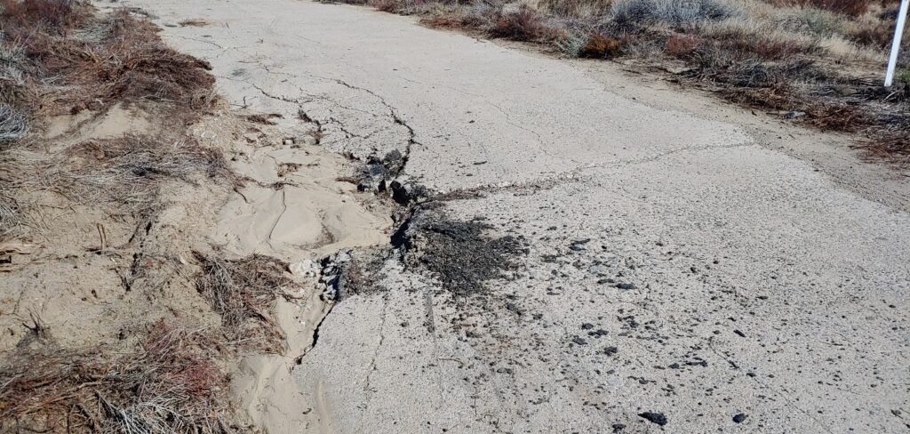
Large pile of melted tire debris and oil on the roadway

Three big rigs traversed the roadway on January 26, as we have noted in earlier reports. We found the location they became stuck, which was about 0.3 miles north of Kelly’s Halfway Inn. We noted multiple locations where they lost traction and spun their tires, leaving large amount of melted tire debris. They got stuck at a large sunken area, creating a large amount of scrapes and pavement damage. They also drove over the edges of the roadway in numerous places, possibly compromising the pavement and culverts in those areas. We are currently working with CHP to obtain information regarding those vehicles.

Signage
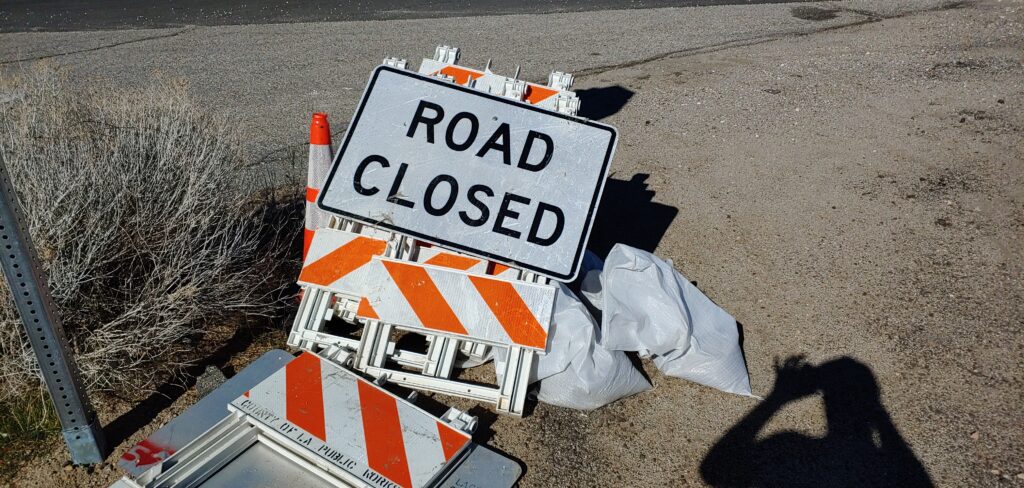
County signage at State 138

Following the January 26th incident, we contacted the County of Los Angeles to help with dissuading people from going over the roadway during the storms. We suggested adding additional signage at both ends of the roadway if possible. They complied and said they’d put up the signs that day. On Saturday, we saw those signs still in place at Templin Highway, Pine Canyon Road, and State 138. We want to thank the County of Los Angeles for their efforts and will be working on getting better, more permanent signage in place in the near future.

Car Chase
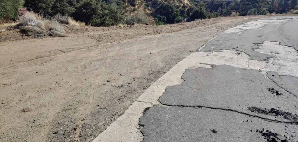
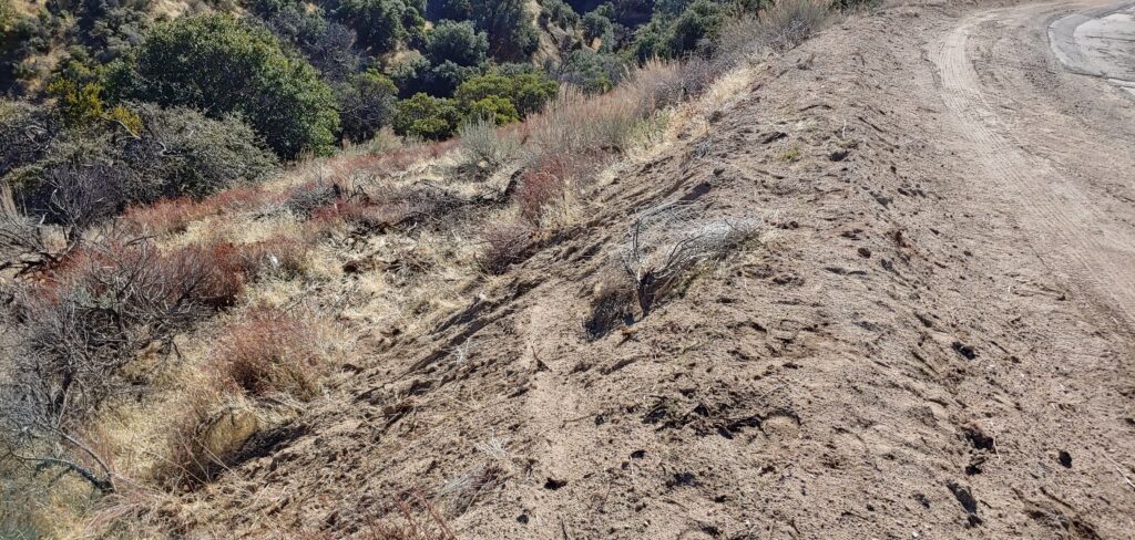
Tracks from where the car left the roadway
Trail where the car crashed off the road

I did mention a car chase involving the Ridge Route. On January 21, a high speed chase ended rather abruptly at the northern end of the Ridge Route, about 1.3 miles south of State 138, well north of Pine Canyon Road. The chase didn’t involve the rest of the roadway, thankfully. The car involved drove off the Ridge Route and the suspects were apprehended shortly after. It doesn’t look like the roadway was damaged but the marks are still there in the dirt.

Snow Storm Update 1/27/2021

It has been a long day but we have at least some news to report. The gates on the Ridge Route are now closed and locked per the USFS. The County of Los Angeles will be placing “Road Closed Ahead” signs today at Templin Highway and Pine Canyon Road. We will be surveying the damage caused by the trucks next month when weather permits, possibly with the USFS as well. We will be contacting CHP to find out if they have any information about the truckers involved so we can begin that process.

Google Maps and Waze are also being updated. Google Maps was updated this morning. Both closures on those sites will require updates, as getting them to mark it as “permanent” or at least “long-term” seems to be a problem. Regardless of what a GPS showed or what conditions may have been, it is still unbelievable that anyone driving a truck as large as that would have even considered going on such a roadway. It doesn’t have a centerline stripe from Templin Highway to State 138, which is a clue the roadway is not a major one. It also goes much higher in elevation than I-5, which again, is a clue it would be worse to travel. That elevation difference is one of the reasons it was bypassed rather than upgraded in 1933. Liebre Summit is higher than Tejon Pass by 110 feet and a lot more treacherous.

We all want to be able to enjoy the scenery along the roadway. Don’t destroy it for the future because you want to bypass a freeway closure or go play in the snow. There are plenty of alternatives that aren’t historic highways to do these things on.

We do need your support to keep things like this from happening again. Part of that support is to let us know if you see or hear anything regarding the roadway, such as trucks being stuck on it during a snowstorm. We don’t always get the information we need and happening upon it, such as we did this time, wasn’t pleasant. If you want to help in other ways, why not become a member, make a donation, or both. Your donation and membership is tax-deductible as we are a 501(c)3 organization.

January 2021 Update

With the recent closures of most of the mountain passes due to heavy snow, we were stunned to find out that people had been traversing the old Ridge Route to bypass those closures. Not only did people in regular vehicles do this, but at least three large tractor-trailers also had done so. These three trucks became stuck just north of Kelly’s Halfway Inn. We will have to assess what damage was done to the roadway as soon as possible but this is very bad news for the roadway. There are at least four sections of the roadway which are extremely delicate as they are partially undermined or otherwise eroded. Other issues can be damage to the remaining curbing along the roadway, broken paving, increased slide potential, and loss of historic artifacts. Large vehicles traveling this roadway during or after a winter storm can severely damage the paving. Travel over the roadway itself during these conditions can also be dangerous due to ice and mud.

The USFS, it would seem, was negligent in their duty to keep the gates closed during this time. The roadway, gates open or not, is still technically closed and no vehicles should have been there. Other people on Facebook, particularly on two group pages, have been incorrectly reporting the roadway to be open and encouraging travel. At this time, I am refraining from calling people out by name but we are well aware of their actions. We have worked hard to keep the road safe. Seeing it damaged and trampled upon by large trucks during a major storm is an affront to all our work. Seeing people touting the roadway as open when it is not works against our efforts.

Once again, do not travel the Ridge Route during or after a major storm. You will damage the roadway regardless of what vehicle you choose, including motorcycles. It might be pretty, but the price to pay is far too high.

Footage of the stranded trucks courtesy of ABC 7 Los Angeles

http://abc7.com/video/embed/?pid=10033309

Forest Closure Order

The Ridge Route, from State 138 to Templin Highway is now under a Forest Closure Order due to the Lake Fire, which is set to expire on December 31, 2020. As such, travel along the roadway and any activities along it are prohibited. Please take heed of this as the fines can be pretty steep.

For further information and specific details, please use the link below.

Lake Fire Forest Closure Order 05-01-20-06

Lake Fire Update

Currently, the Lake Fire is at 31,089 acres and 70% containment. Unless something dramatically changes, it looks like the Ridge Route will be safe from this fire. There is, however, another issue which we will have to clarify with the USFS. The area is now under a Forest Closure Order, which is set to expire at the end of December 2020. As such, the roadway and any activities along it may be prohibited. For further information, please use the link below.

Lake Fire Forest Closure Order 05-01-20-06