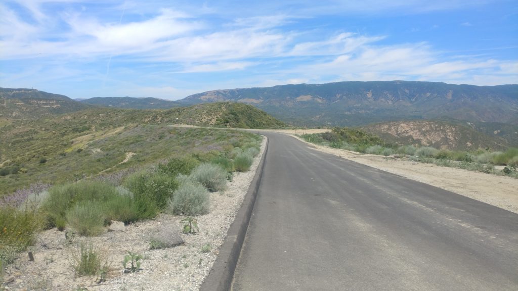
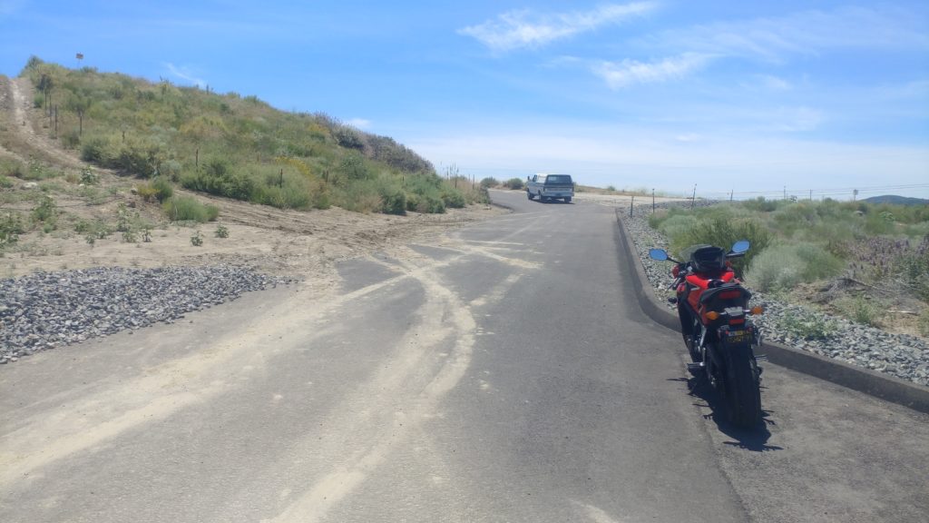
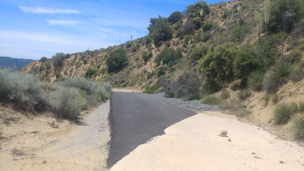
Finally, some good news! While it is not finalized at the time of this writing, our Volunteer Service Agreement is nearing completion. We got a copy today to review and so far, things look quite promising. We will also be getting a key to the gate, which means we will have access to the road. My first act, after getting the key, is to do a preliminary survey of the road to assess the general condition of the roadway and determine what needs to be worked on prior to the upcoming rainy season.
What this means is that we are planning to do work on the Ridge Route in late Spring 2020, after the rains have subsided. Details on this event will be posted once we get a bit more information together and work out what the event will entail. The agreement does have a few stipulations, mostly regarding how our events will be held and what we can do during them. One of those is that we need to give a list of all attendees prior to an event, as such we will be expecting all persons attending to let us know before they attend.
So, things are looking up for the Ridge Route. Work is still in progress regarding Forest Service maintenance, right-of-way, and land ownership issues. Those will take a while but I have confidence they will be resolved in due time. In the mean time, plan on going on the road in late Spring 2020 and prepare to work!
Greetings all. I know it has been a while since there has been an update. Things are progressing, slowly. We are actively working with the Angeles National Forest in obtaining a Volunteer Agreement, which will allow us to get back up there and work on the road. Details of the agreement are still in the works but we should be getting some details in the next couple of weeks. We would have had them last week, but the Tick Fire, Tick Branch 10 Fire, Saddleridge Fire, Val Verde Fire, and a few others have been distracting the forest service as of late.
With these fires in mind, so far the Ridge Route has been unaffected for the most part. Two fires, started along I-5 by cars, did burn toward the Ridge Route a mile or two north of Templin Highway. These were thankfully not during a high wind event, which allowed them to be put out sooner. Please use extra caution in ANY portion of the forest or wild lands during this time of year. We haven’t had any real rains yet, the vegetation is very dry, and the winds can be strong. Gusts today were recorded at over 60 mph at the top of the San Gabriel Mountains above Santa Clarita. Winds in the past have been recorded at near 100 mph at Whitaker Peak, which is just north of Violin Summit where Templin Highway crosses I-5.
Once we get our agreement in place, after this devastating fire season is over, I am hoping to get things going again on the road. Depending on what the agreement allows, I am looking to do a survey of the state of the roadway between the gates. Photos and information will be posted as soon as they can. Ridge Route work parties will also commence, hopefully sometime in 2020.
Opening the roadway is still a work in progress. Many steps need to be taken before it can happen, unfortunately. Funding for maintenance, getting the road back on the maintenance schedule, land ownership issues, and personnel issues all need to be resolved prior to opening the road. All of them are surmountable and many have the support needed. We will keep fighting to achieve our goal of getting the road back open to travel, even if it means the road is open in a limited capacity.
Well, its August 2019. The concrete on the Ridge Route is at or over its 100 year anniversary. For its age and all its gone through, it is still in pretty good shape in many places. Others, not so much. Those, at least south of Reservoir Summit, have been mostly corrected. I haven’t had an opportunity to traverse the roadway from there to the Tumble Inn, but reports from others and a review of aerial and satellite photography seems to give good news on that front.
We are still working with the Angeles National Forest to solve any right-of-way issues and to work toward getting the road opened. One of those items is via volunteer work. When we reach that point and start to plan work parties on the road, we will need your help and support. More information on that work, as well as how to join us, will be posted here when the time comes.
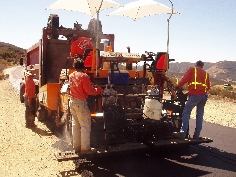
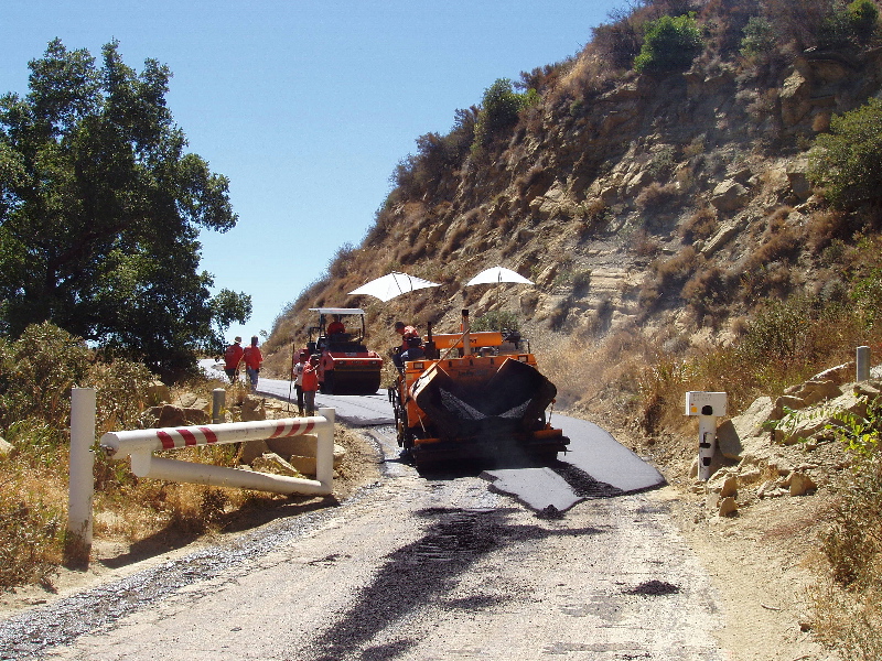
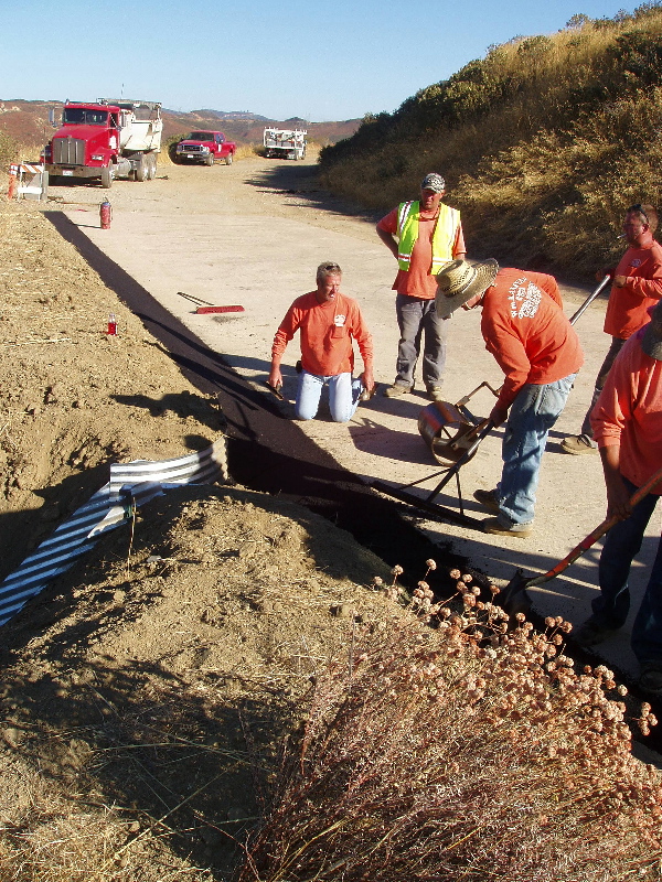
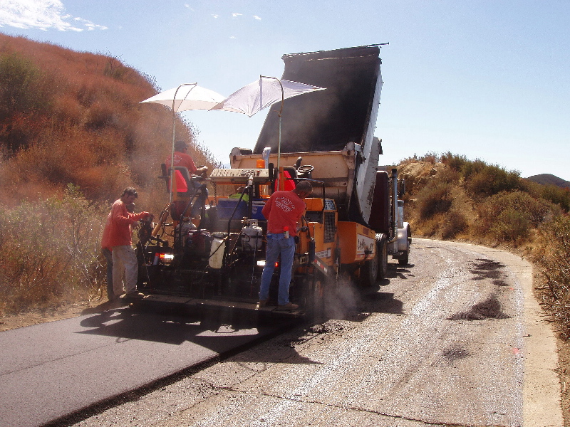
In April, we received the information we had requested from the Forest Service regarding the 2010 paving at the southern end of the roadway. What we got was quite helpful and explained a few things. The paving was done, for better or worse, in an attempt to help preserve the original paving. A long section of concrete was also poured, using the original specifications, to replace a section of roadway that had been lost to landslides in the recent past. While we applaud the Forest Service for doing this, we can only do so with apprehension. The Ridge Route paving is a large part of the historic aspect of the road. Rarely is the roadway itself the piece of history. A wholesale repaving of the roadway would destroy what is there and leave little for the public to enjoy in the future. Repairing and repaving small sections, when necessary, is acceptable to a point. We plan to work more closely with the Forest Service to make sure such paving is done with the proper care and understanding this road needs.
Below are some photos of the road work from 2010, taken by the Forest Service and the contractor. A link to the contract itself can be found here – 2010 Forest Service Rehabilitation Contract.
On Monday, June 10, Michael Ballard (myself), Harrison Scott, Dave Omieczynski, and Richard Valot had a meeting with representatives from the Angeles National Forest. They included Jerry Perez – Forest Supervisor, Justin Seastrand – Environmental Coordinator, Ricardo Lopez – Road Engineer, and Jamahl Butler – District Ranger. Our meeting, which was held on the Ridge Route near the southern end, was to discuss a range of topics regarding the road. We initially met at the Ridge Route and Templin Highway where we made introductions and briefly went over the meeting details. From there, I led the group with my sportbike up the road to the southern gate. At that point, we discussed the land ownership problems and the 2010 paving, which we believe will help us with our goal of getting the road reopened.
After our discussion, they opened the gate and I led the
group on a tour of the Ridge Route from the southern gate to Reservoir Summit.
The initial plan, however, was to only go about four miles north to see the
recently reconstructed section of road. Each stop, the USFS people decided to
go a bit further. We didn’t mind this at all! Along the way, we made stops at
some of the sections of the roadway that had been repaired as well as some of
the historic sites along the road, such as the National Forest Inn site. At
each major stop, Scotty brought out his books and showed photos of the sites.
Once we got to Reservoir Summit, we had another discussion
regarding the state of the roadway. Overall, it was in very good shape with
only a few areas needing more immediate attention. Many sections had been
resurfaced and we did make it clear that we didn’t want to see a wholesale
repaving of the roadway for the sake of preservation. They seemed to understand
this. After our discussion and hike to the reservoir, we all headed back to the
southern gate to finalize our meeting.
The meeting was productive and positive. There is still a lot of work to be done, but they were willing to help and to work with us. Instead of a Memorandum of Understanding, we may be entering into a Volunteer Agreement regarding cleaning drains and such along the roadway. They also stated they would do additional research regarding the land ownership issue at the southern end of the roadway. In regards to opening the roadway, there is still no estimate on when it will reopen. Another concern is roadway maintenance, which we may be able to help defray with volunteer effort. There are still additional issues that need to be addressed but we at least have a better understanding of what the Forest Service sees as the problems. One of them, overall condition of the roadway and ability for vehicles to travel safely, I tried to prove by using my sportbike. If I can go on the roadway using that vehicle, most everyone should be able to pass over it safely as well.
Only time will tell if this meeting was truly successful,
but I believe it was. I will give additional updates when we hear back from the
USFS in the near future.
There has been some positive movement regarding progress on the Ridge Route lately. We are presently working with the USFS to update and renegotiate our Memorandum of Understanding, so that we can go back up on the road to clear the drains and remove rocks from the road. We also have a meeting coming up with USFS Forest Supervisor with the Angeles National Forest in early June. I am looking forward to this meeting, which I think will be productive and good learning experience for all.
We also recently received the documents requested regarding the 2010 roadway paving, which has been quite enlightening. I plan to post that information in the near future.
The roadway remains closed at this time. As stated in the past, if you find either gate open, you pass at your own risk. The gate may be locked behind you. Always use caution along any portion of the road, as there may be rocks, animals, other people, reinforcing bar, and other hazards.
I will post another update after the meeting with the Forest Supervisor.