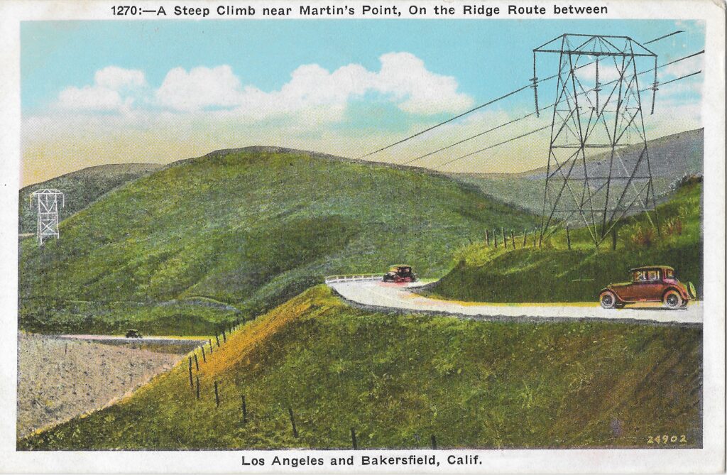
September – October 2021 Newsletter

August CUTRR Event

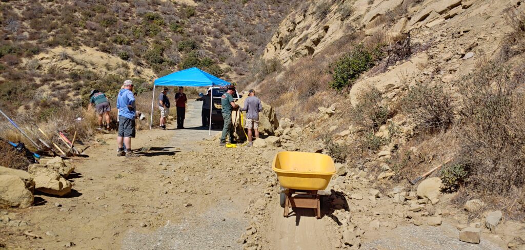
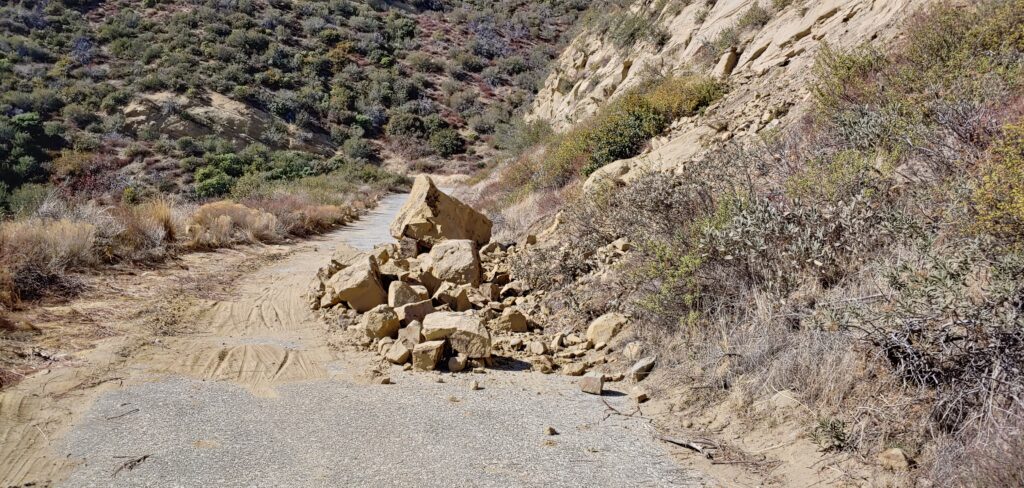
On Saturday, August 28, we held our first 2021 CUTRR event. Each event has a section of roadway to focus on and this one was to remove a large rockslide that occurred in January 2021 below Swede’s Cut. The event was advertised on our website and on our social media accounts. It was a huge success! We had a much larger group than I had expected and we completed our task. The rockslide has been removed and the roadway is clear!

The slide, as it was in February 2021 and what we had to clear.

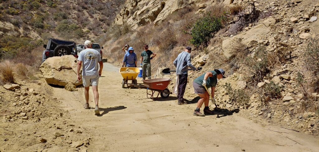
The big boulder visible took a lot of work to deal with. At first, we worked to break up the boulder, which slowly chipped away at its bulk. We had hoped to break it down yet further but reached a point it was too difficult given our tools and the heat. We decided the best course of action was to move it across the roadway and off the pavement. Between a truck and a jeep with tow straps, we were able to finally drag it off the roadway with minimal damage to the historic pavement below. Eventually, we hope to completely remove the large boulder either by further breaking it up or removing it in its entirety to another location.
Crew at work clearing the slide. Moving the big boulder took some time.
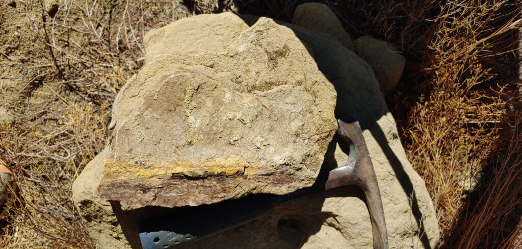
Fossil leaves from the upper Miocene Ridge Route Formation. Found in the slide material.
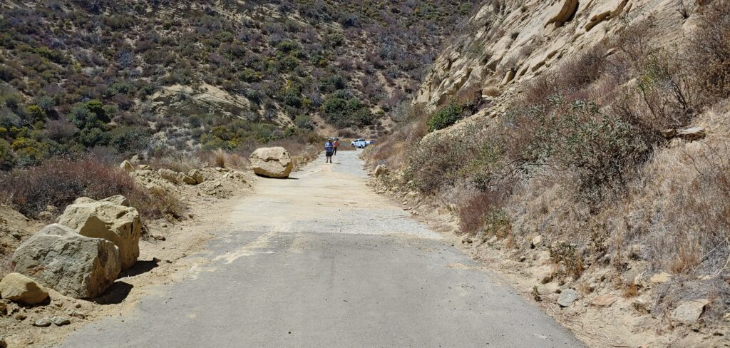
Almost done clearing the debris. The big boulder is now moved across the road and out of the way.
Roadway cleared and swept.

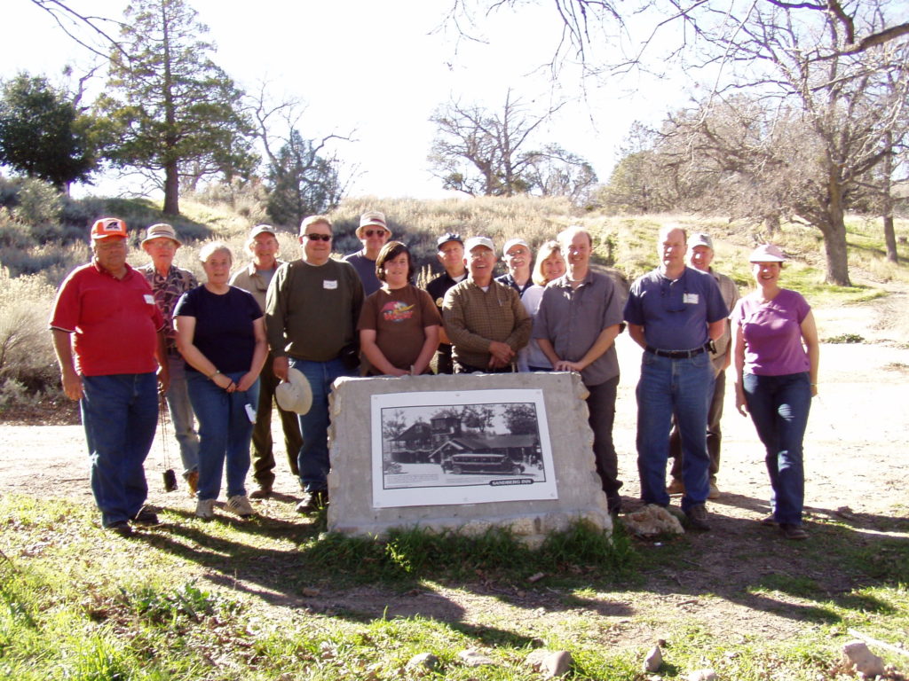
I want to thank ALL the volunteers that were able to attend. It was really a great and enthusiastic group. We could not have done this without all of you!

A video of the event was also posted on YouTube by one of the participants, Sydney Croasmun.

An additional video with aerial footage was posted by Huck Outdoors.

October CUTRR

We are planning another CUTRR event in October when temperatures will hopefully be cooler, however at this time we do not have a date set. We will be developing a better list for tools similar to a “potluck” for signups. Look for updates coming in the near future. If you would like additional information, have tools or equipment you’d like to offer for use, please let us know!

Roadway Update

The roadway is overall in decent condition but many problematic sections still exist. The northern end from the Liebre Maintenance Camp site to Sandberg has a few larger dirt-covered sections and areas where the culverts are partially clogged. Some sections of 1924-1927 asphalt are also failing. We intend to get work parties up there to rehabilitate the failing asphalt and remove the material on the roadway in the near future.

The roadway does remain closed between the Tumble Inn and just north of Templin Highway. While the gates have been left open, usually by the utility companies working along the road, anyone traveling up there should expect the gates to be locked. If one is unlocked, don’t expect the other to be as well. Please exercise caution along the roadway. We all want to keep the roadway around for the future and everyone can help do their part in ensuring that.

Forest Closure

All National Forests are closed from August 31, 2021 to September 17, 2021 per a recent USFS press release. This includes access to the Ridge Route from Templin Highway to State 138. For detailed information, please see the link below.

Website Subscription

Make sure to subscribe to our site to get updates on upcoming events and Ridge Route news.

Featured Photo

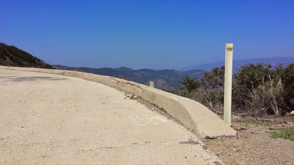
Curbing just north of Martins

Concrete curbing used to be much more common along the Ridge Route. It was used in places where wooden railing was more difficult to install. As the roadway was realigned, the curbing was removed. Today, very little remains of what once was miles of it. Only four short sections remain today. Those are located at the Callahan Line Change, just north of Martins, Serpentine Drive, and Grapevine.

August 28 CUTRR Event

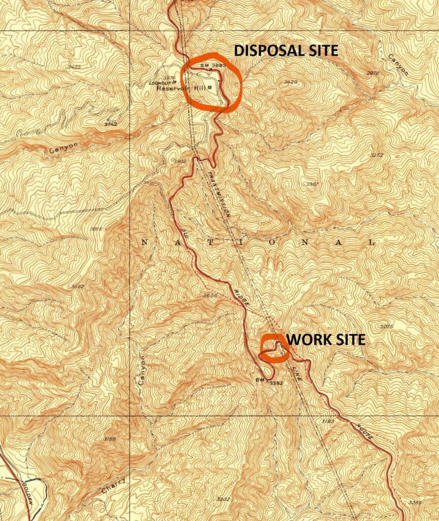
After many delays and other issues, we will finally be hosting our first Clean Up The Ridge Route (CUTRR) event on Saturday, August 28, 2021. We will be meeting in Castaic in the parking lot of Mike’s Original Diner (31537 Castaic Rd, Castaic, CA 91384) at 8 am and leaving by 8:30 am to the work site. It may be hot, so bring plenty of water and food. Please make sure to carpool as we want to reduce the number of vehicles on the roadway. This CUTRR will concentrate on the large rockslide south of Swede’s Cut and, if there is enough time, Swede’s Cut itself. We will need tools such as picks, shovels, rakes, pruning saw, pole pruner, mattocks, clippers, wheelbarrows, brooms, and a vehicle to haul away materials to our designated disposal site at Reservoir Summit.

Contact us for additional details or if you’d like to RSVP for the event. We look forward to seeing you out there! Let’s get the road cleared!

Ridge Route Meeting

Let’s talk! On Wednesday, July 14, 2021 at 1800 (6 pm), I will be hosting an open meeting via Zoom on the Ridge Route. We will discuss the current status of the roadway, our plans for roadwork, and answer any questions you might have about the roadway.

If you have questions about our upcoming CUTRR event, this would be a good time to do so. Looking forward to seeing you all at the meeting! Make sure to register ahead of time. There is much to discuss now that we can hold in-person events again.

http://zoom.us/meeting/register/tJUuc-mtrz8tGNUd_qJrOcU_AyFq80p9XWZd

July-August 2021 Newsletter

The Grapevine or The Ridge Route?
by Michael F Ballard

The Grapevine. Courtesy – Caltrans

I-5 is commonly referred to as “The Grapevine” by locals and traffic reporters. Most assume the name derives from the twisty nature of the original roadway – the Ridge Route. That road was indeed very twisty, much like a grapevine. However, that is still not the reason. The name Grapevine actually comes from Grapevine Canyon, where old US 99 and I-5 come down from the mountains and into the San Joaquin Valley. The canyon is called such as wild grapes grow along the canyon walls. It was formerly known as Canada De Las Uvas which is Spanish for Canyon of the Grapes. The name Tejon Pass is also a “new” addition to the area. The current Tejon Pass was known as Grapevine Pass or Badger Pass until the 1850’s. Old Tejon Pass, much farther to the east, was a very treacherous route. That pass was eventually abandoned in favor of the current Tejon Pass. The name was just shifted to the new route.

After the 1933 bypass of the original road to as late as the 1970’s, the roadway over the mountains was still referred to as “The Ridge Route”. It wasn’t until the 1980’s that the name “The Grapevine” was extended to the entire roadway. Why this was done is still unclear. Even Caltrans called it the “Ridge Route” when I-5 was completed. So, if you want to call it proper – call it Tejon Pass, when being specific to the actual pass, and the Ridge Route when referring to I-5 from Castaic to Grapevine. While you’re passing through Grapevine Canyon, be sure to spot the wild grapevines that still grow in the canyon. Names may change, but the name Ridge Route should live on. It applies to I-5 better than “The Grapevine” ever will.

Events

After many delays and other issues, we will finally be hosting our first Clean Up The Ridge Route (CUTRR) event on Saturday, August 28, 2021. We will be meeting in Castaic in the parking lot of Mike’s Original Diner at 8 am and leaving by 8:30 am to the work site. It may be hot, so bring plenty of water and food. Please make sure to carpool as we want to reduce the number of vehicles on the roadway. This CUTRR will concentrate on the large rockslide south of Swede’s Cut and, if there is enough time, Swede’s Cut itself. We will need tools such as picks, shovels, rakes, pruning saw, pole pruner, mattocks, clippers, wheelbarrows, brooms, and a vehicle to haul away materials to our designated disposal site at Reservoir Summit.

Membership is required to attend due to USFS volunteer requirements and you must RSVP prior to the event. If you just need a one-day membership, you can get one for $10 using our online form or via the mail by check.

Contact us for additional details or if you’d like to RSVP for the event. We look forward to seeing you out there! Let’s get the road cleared!

Roadway Update

We have been getting many reports lately that the roadway is open at both ends. This may well be the case, but please understand, this is not the standard position as yet. It is likely the utility companies have been leaving the gates open instead of closing them after they pass through. This does indeed create a problem where people can get stuck between the gates. Both gates have writing on them attesting to this.

We are working to get them open on a more permanent basis but it will take a while. There are issues with the roadway which do need to be dealt with before even the RRPO wants the roadway open. There are numerous places where the reinforcing bar in the concrete is exposed, potholes in the asphalt that are getting worse, and many other problems that can cause more damage when traversing the roadway. Please remember, we are here to help preserve and protect the roadway. Travel over it is also a goal but not at the cost of the roadway itself. Now that we are getting CUTRR events going again, we may well see improvements to the roadway quality. Why not join us and help protect the roadway we all enjoy?

Featured Photo

Looking north from the Ridge Route near the National Forest Inn. Courtesy – Michael F Ballard

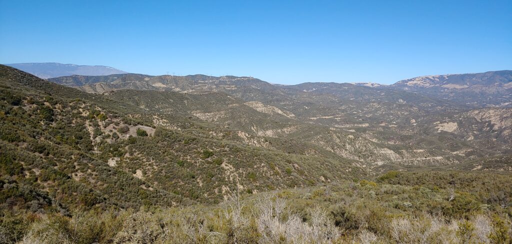
The Ridge Route is well known for its views. Wide expanses of open land, mountains, and canyons as far as the eye can see. One of my favorite viewpoints is just south of the National Forest Inn looking northerly. From there, you can see all the way to Liebre Summit with Kelly’s Halfway Inn and Reservoir Summit plainly visible. To the west, the distant peak of Frazier Mountain (8000′) is visible.

March 2021 Newsletter

Lost section of roadway near the south end. All of the visible roadway from the middle car and below was destroyed in the early 2000’s.

THE 17 MILE DRIVE

Not the famous 17 Mile Drive in Monterey California, I’m referring to the historic 17.6 miles of the original 1915 Ridge Route that provided a direct north/south route over the barrier of the San Gabriel and Techachapi mountains.  This route provided a commercial conduit to connect northern and southern California.  Seventeen point six miles of the original highway lie entirely within the Angeles National Forest and are recorded on the National Register.

The sad thing is it is currently closed to any motorized vehicle. The only legal permitted entry currently is to hike, bicycle or horseback in, but I can assure you the adventure is worth it.   The focus of the Ridge Route Preservation Organization is to preserve this historical landmark and work with Angles National Forest to explore avenues to possibly acquire at least limited vehicle access for public enjoyment, especially for the disabled that depend on others to provide transportation.  For those worthy of the task, take ample water and a cell phone.  Cell service is spotty.  Be watchful of snakes during summer months.  Your reward will be spectacular views and how turn-of-the-century highways were built.

– Harrison Scott

Road Updates

Nothing much to report this month on the roadway. Things have quieted down a bit since the issues in January. We are still following up with CHP to find out what happened up there with the vehicles. It also seems the utility companies are the main culprits for the gates being open. Keep in mind, we are working toward having the gates open much more frequently, but only after we get a better handle on maintenance of the roadway. At present, the roadway is still considered closed and, should you pass the gates, you may well find yourself locked in. The plan we are working on with the USFS will likely be a winter closure of the roadway to reduce the possibility of damage to the paving by cars during storms.

Membership

We recently made some changes to our website to allow online membership applications. If you were a member in the past and would like to renew, or you’d like to become a new member, it is a whole lot quicker and easier now. If you’d like to join or renew, please use our online membership form. We still have our mail-in method as well. Keep in mind your donation may be tax-deductible as we are a 501(c)3 organization.

Events

In-person events, such as a CUTRR or tours, are still on hold due to the pandemic. As things are improving, albeit slowly, we anticipate being able to hold some sort of event much later this year. An exact time is still uncertain. It doesn’t mean we can’t hold other events, such as online meetings. Our first online meeting, using Zoom, will be held on Wednesday, March 3 from 5:30 pm to 6:30 pm. This meeting is open to the public and registration is required. We plan to hold more meetings like this in the future to help inform the public about what is going on with the roadway and the RRPO. Come join us! Use the link below to register.

http://zoom.us/meeting/register/tJYqcuitqT8pHNP2d5qYGw3OmKdFfxy6h5p3

Fundraising

Our online fundraising has been going rather well. We recently changed our PayPal account and validated our non-profit status with them. As a result, they have reduced the fees they charge us and have an option to cover those fees during a donation. While it is a small change, every bit helps. We do wish to thank all those that have donated. We will need those funds in the near future for a few possible projects on the roadway, such as pothole repair and modifying the gate at the Tumble Inn (Fisher Springs gate). Your donations help ensure the roadway will continue on into the future.