February 2024 Storm Report

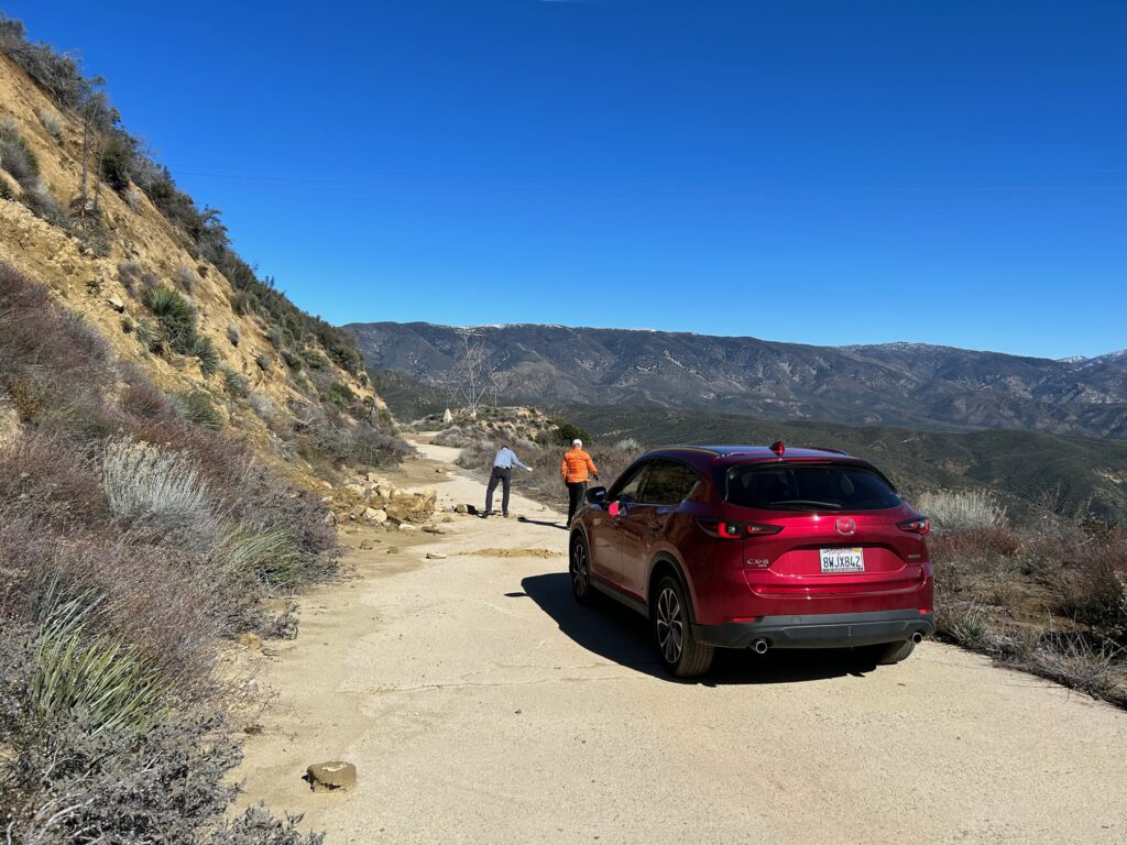
On Saturday, February 10, two board members (Michael Ballard and Jaime Crawford and two volunteers, went on a survey trip over the Ridge Route to assess the damage from the February 4-9th storm. We were surprised by what we saw, most of which was encouraging.

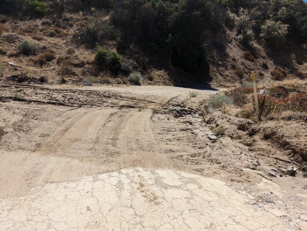
The southern gate was partially blocked by a rockslide, which wasn’t a good start. It was easily cleared by our crew and we moved north to the early 2023 landslide. The work done in late January by the RRPO to cover the slide and divert water did seem to help quite a bit. After making minor repairs and adjustments, we continued north towards Serpentine Drive. A minor slide from early 2023 showed no additional signs of movement but was still partially blocking the roadway.

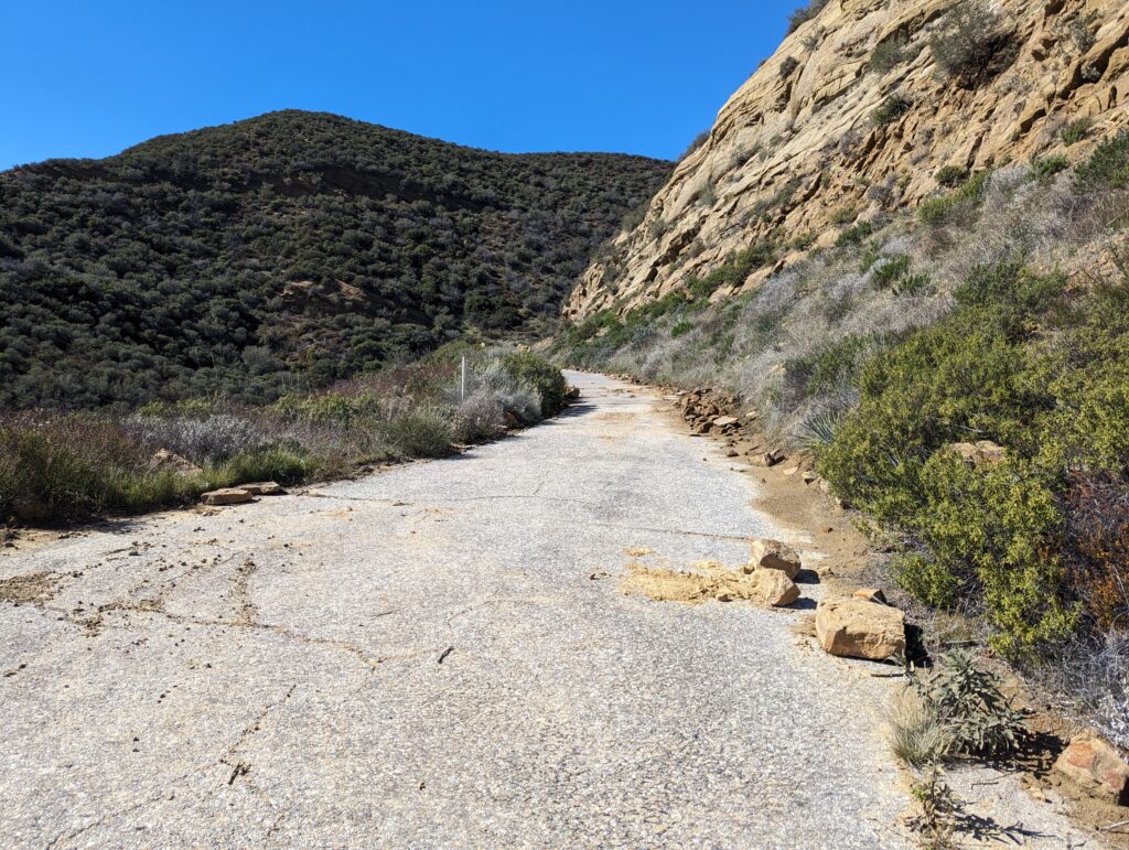
Few rockfalls or slides were observed between the National Forest Inn and Serpentine Drive. This section was the site of three major slides in 2005 which completely shut down the roadway and damaged oil/gas pipelines in the area.

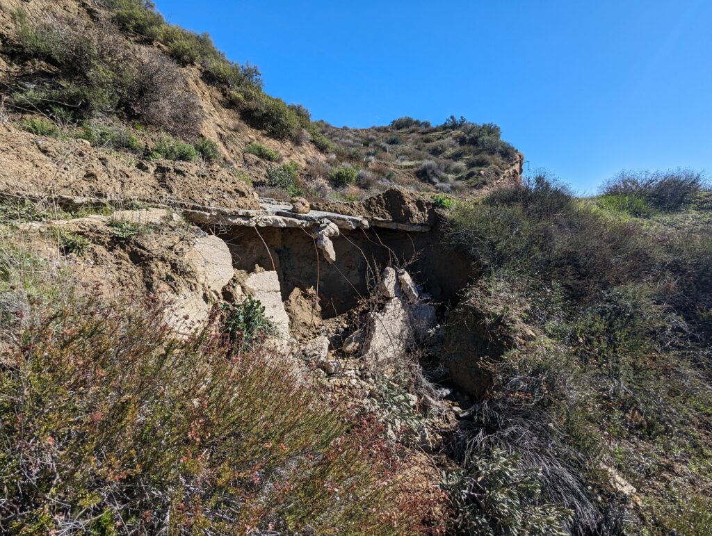
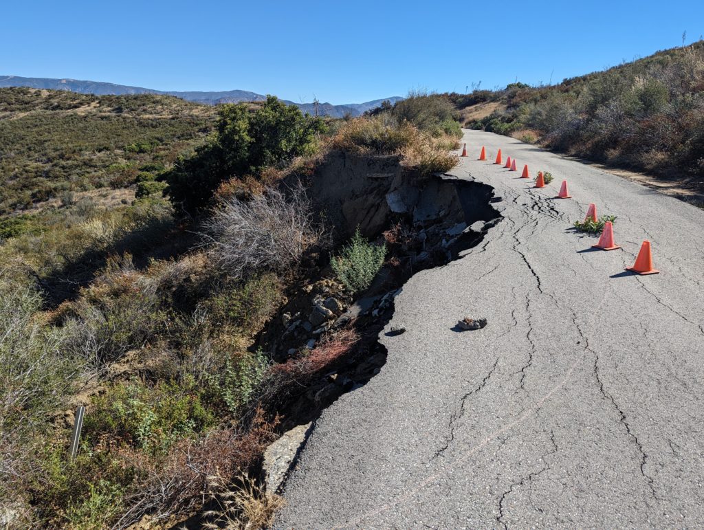
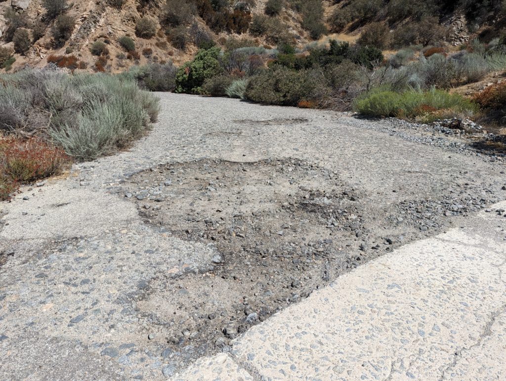
At Serpentine Drive, we did note two problem locations. Both are known issues which are tougher to solve. The first, a developing washout near the pipeline bridge, has gotten a bit worse. The roadway is undermined and gradually breaking up. For now, we intend to divert the water to reduce further damage. Longer term plans call for reconstruction of this section with proper drainage installed. A bit further up, a rockslide partially blocked the road, which was mostly cleared a couple of times in the last couple years.

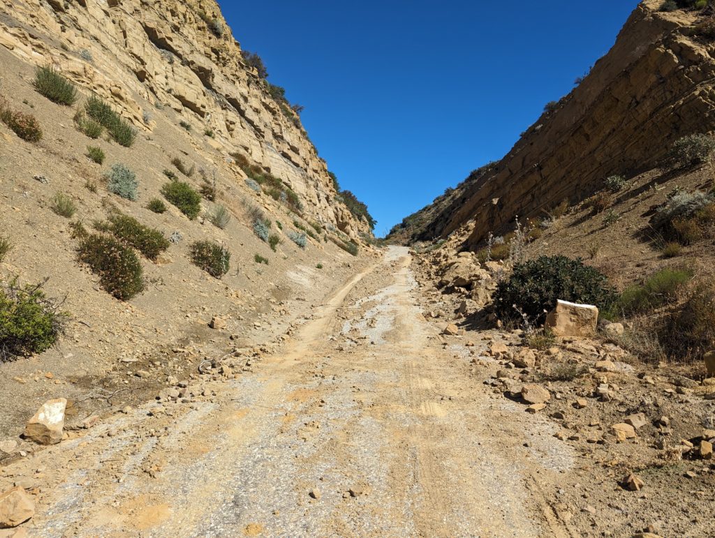
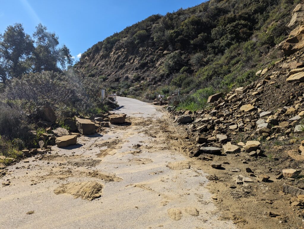
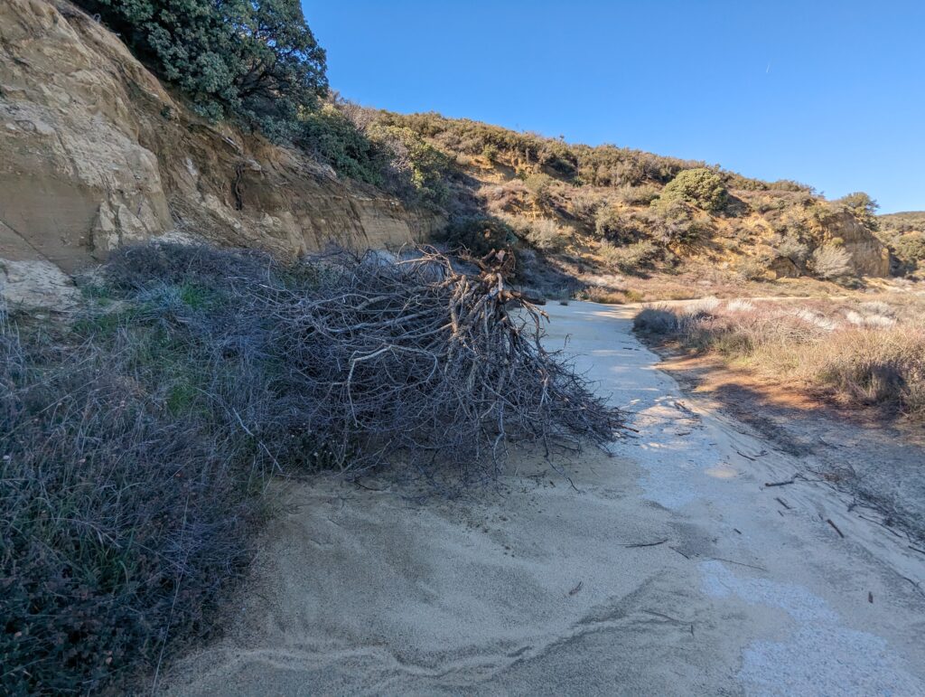
At Swede’s Cut, we found quite a bit of debris blocking the road which required some work to make passable. This location is usually the site of many rockslides.

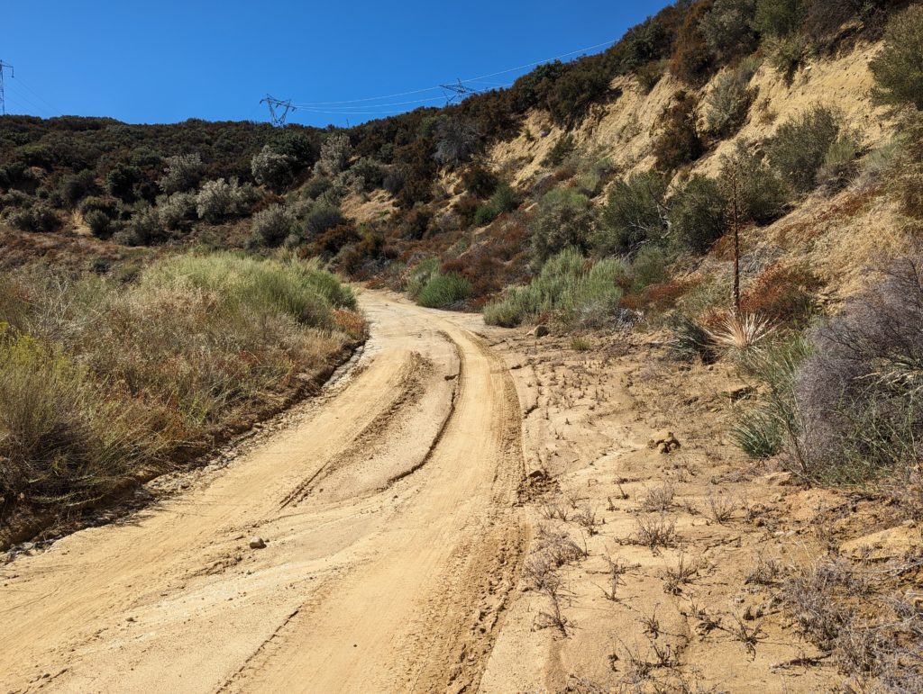
South Reservoir Grade was fairly clear, much to our surprise. The storms in 2023 brought down quite a bit of rocks so we expected a lot more this time. So far, things are relatively clear with some areas being covered by sediments at stream crossings.

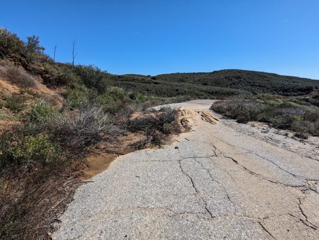
North Reservoir Grade, however, had a couple locations where a large amount of material has come down onto the road. Most is softer sands and mud with some larger rocks interspersed. All will require a blade to clear along with the adjacent drains unclogged.

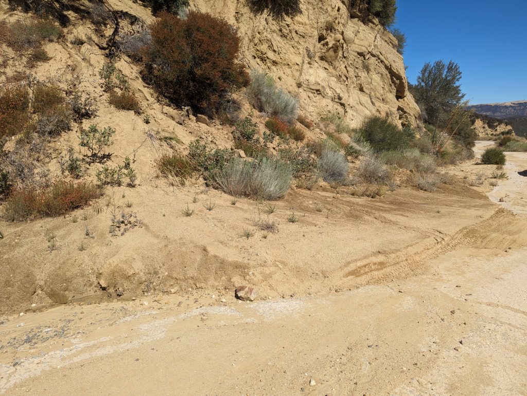
All of the areas we have worked to clear the drains so far have held up well and are in good order except for one at the northern end. We’ll get back to that one in a bit.

Sandbags placed by RRPO to divert water away from a major washout near Kelly’s.

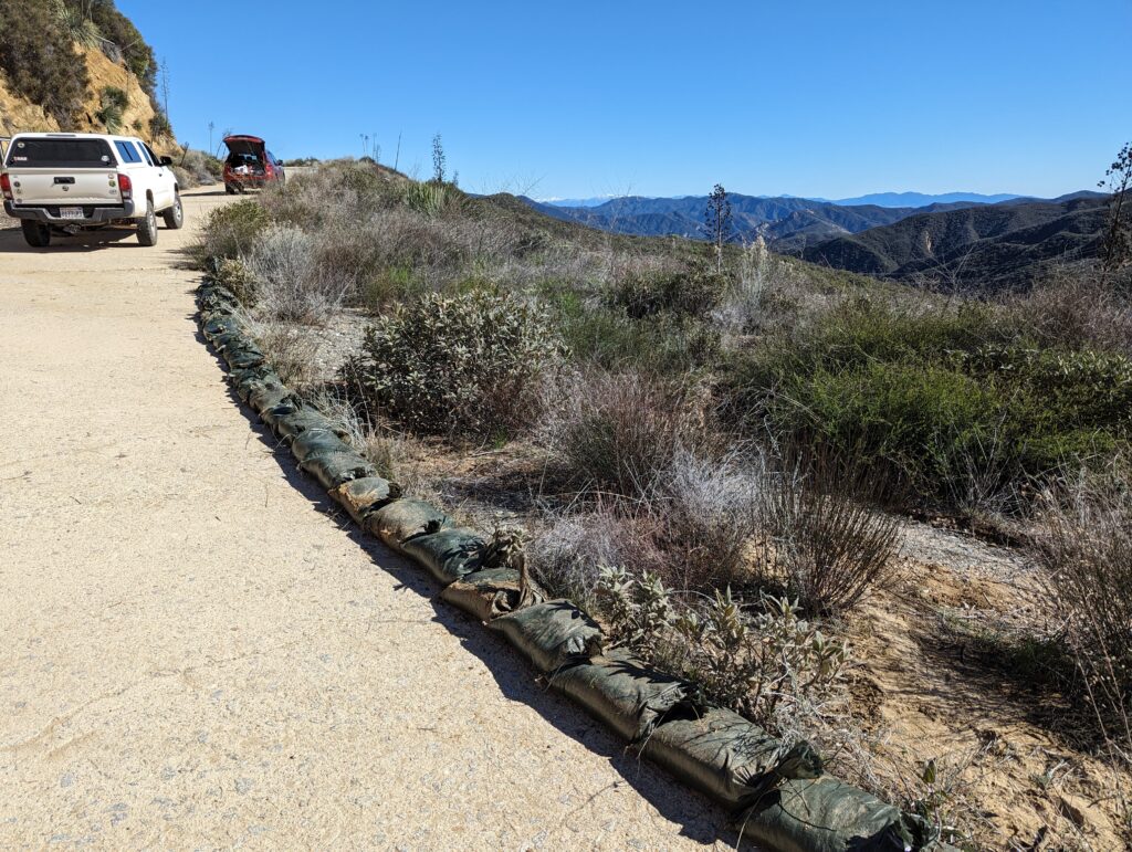
At the large washout near Kelly’s, we stopped to survey how the sandbags held up and if any changes needed to be made. We found the bags had indeed worked well except for at the upper end. As a shorter-term solution, we relocated some of the bags to further push the water away from the drain as the upper end was getting overwhelmed with sediments. Additional work will likely include additional sandbags to raise the level and divert some water into a drain on the uphill side of the roadway.

South of the Tumble Inn, a dead tree partially blocks the road.

Just south of the Tumble Inn, we stopped to clear a tree which had fallen onto the road. As the cuts erode, we expect more of these to fall in the future. The only thing we can really do is keep an eye on any that are large enough to block the road and mitigate the damage as best as we can.

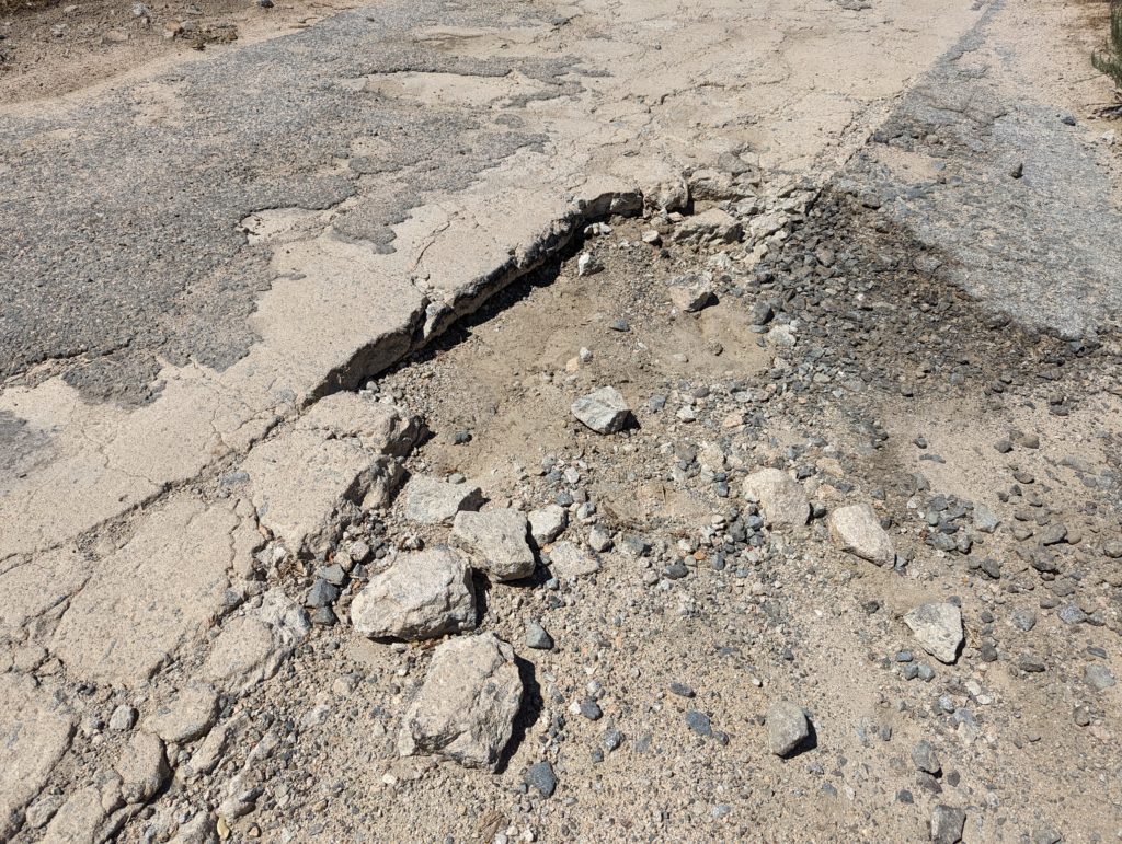
Between the Tumble Inn and Liebre Summit, the road was quite muddy in places with a large amount of debris covering the road. Two major drains are blocked or otherwise compromised and need to be cleared. The roadway itself needs to be bladed. Some of the potholes have gotten worse, with the largest one near Horseshoe Curve. That will “Pothole #1” to be taken care of as the concrete is breaking up in addition to the asphalt.

Upon reaching Sandberg, we discussed options for future repairs and maintenance of the roadway. In addition to the photos, we also took about 40 minutes of video which we are putting together and will post on our YouTube channel in the next month or so. We also do not recommend traveling the roadway between Sandberg and Templin Highway during this time regardless of the gates being open. You can damage the roadway and possibly injure yourself in the process, neither of which we want to happen.

Your help will be greatly appreciated and necessary to ensure the roadway remains intact. We look forward to hearing from you and seeing out there at our next CUTRR event, which will be posted soon.

Quick Ridge Route Update

Two board members of the RRPO and a couple additional volunteers surveyed the Ridge Route earlier today. The results were very surprising and overall good. The Ridge Route survived the storm! We were able to travel the entire road with only some issues. A more in-depth update will be posted on Monday.

Due to overall conditions and the winter storms, any travel over the road beyond the gates is NOT RECOMMENDED regardless of the gate status.

February 2024 Preliminary Storm Report

The Ridge Route area has been hit by very heavy rainfall over the past few days. Over the last three days alone (as of 1400 on 2/5/2024), per Los Angeles County rain gauges, Sandberg has had 3.74 inches of precipitation and the Castaic Powerplant has had 5.39 inches of precipitation. Other reports estimate up to 7-10 inches in the area. Most of this fell from Sunday afternoon to Monday afternoon. We are expecting heavy damage along the roadway with multiple slides at this time. The hardest hit area is between Reservoir Summit and the National Forest Inn site.

At this time, we do have not been able to inspect the roadway due to the ongoing storm. We anticipate being able to go up there as soon as the 10th or 11th. So far, the weather looks to improve toward the 17th, which is our first planned CUTRR event this year. If the weather is good for that weekend, we will need all the help we can get. Further updates will be posted as soon as we can.

RRPO Updates

From Michael F Ballard – RRPO President

Greetings All!

Some good news for the road. It looks like we will be getting approval for our pothole repair project from the USFS in the very near future. As winter is approaching, we intend to do this project when weather permits, likely early next year. We are also working with the USFS on gate repair and landslide mitigation. The latter, regarding the landslide on the south end of the roadway, will take a while but we will prevail as we have in the past. More updates will be posted soon, so make sure to subscribe to our site if you haven’t already. We need your support to keep these projects going!

On another note, we will be needing a new RRPO Board Secretary. Our current secretary, Richard Schwartz, is retiring from his position and has served the RRPO well during his tenure. If you’d like to apply for this position, please contact us and we can talk. We can use your help!

Thank you all for your help and support.

Ridge Route Condition Update – August 2023

Last weekend, we took a trip over the Ridge Route to assess damage caused by Tropical Storm Hilary. According to the LA County Department of Public Works, Sandberg and Castaic received a little over 4 inches of rain during the storm. Most of this fell in a day, which is a lot for that area. We were concerned additional damage may have occurred to the road. We were pleasantly surprised by what we found.

The storm itself caused little damage to the roadway with few exceptions. Most of the damage was localized to three locations, the Spring 2023 landslide at the south end, Swede’s Cut, and near the Liebre Maintenance Camp site. With the exception of one site, all the work that had been done at our CUTRR events was successful. The drains we cleared remained clear and worked well. We wish to thank all that have helped us with our events. We couldn’t do it without you all. We need to continue this work as well as other restoration work as time permits. Dates for upcoming events will be announced soon.

Landslide from Spring 2023. This has moved a bit more since May 2023.
Swede’s Cut in August 2023. This was cleared earlier this year but the recent storm caused more debris to collect. Still passable but narrow.

North of Reservoir Summit, the roadway degrades in quality a few times. The most notable is about 0.5 miles north of Reservoir Summit where a large amount of debris has washed down from the slope above. The drains are mostly intact with some partly blocked. Two larger mudslides partly block the roadway as well, adding to the debris problem by blocking drainage. We are working on a solution for this, which will likely be using a blade to clear the road.

Just north of Reservoir Summit, looking south.
One of the larger debris cones partially blocking the roadway. These are from earlier this year and were augmented by the tropical storm.

The northern end of the roadway from the Tumble Inn to Sandbergs is still open to traffic after the storm. However, it is not recommended for standard autos or lower clearance vehicles at this time due to the increased amount of debris on the roadway. One location in particular, shown in the photo below, makes it nearly impassible for such vehicles.

Debris crossing the roadway near Liebre Maintenance Camp. This was the site of one of our CUTRR events in October 2021. Our work did help for a while but an ever-increasing amount of sediment has once again blocked the roadway. The drain, which we cleared at that time, has remained in good shape.

Heading north toward Sandbergs, a few locations where the pavement was breaking up were noted. We are working with the USFS to get these repaired, even on a temporary basis, in the very near future.

At Horseshoe Bend, a large pothole is forming which we intend to repair as soon as possible.
Concrete and asphalt breaking up near Liebre Summit. This is one of the worst sites we plan to repair. The winter storms and the tropical storm have made this section a lot worse.