Currently, the Lake Fire is at 31,089 acres and 70% containment. Unless something dramatically changes, it looks like the Ridge Route will be safe from this fire. There is, however, another issue which we will have to clarify with the USFS. The area is now under a Forest Closure Order, which is set to expire at the end of December 2020. As such, the roadway and any activities along it may be prohibited. For further information, please use the link below.
As I am sure some of you are aware, there is a large fire burning in the mountains near Lake Hughes. This fire has been slowly burning west toward the Ridge Route. Whether or not it reaches the road remains to be seen, but hopefully it does not for many reasons.
Should the hills around the road burn, it would dramatically increase the chances for mudflows and debris covering or damaging the roadway. At a time when maintenance is at a low, this would not be good. There are also items of historic value that are flammable in the vicinity of Sandberg, which would also be preferable not to burn or otherwise be destroyed. The historic Knapp Ranch is also at risk and the fire is slowly getting close to it.
We have been monitoring the situation and will survey the area once the fire is over. Presently, the Ridge Route is closed from State 138 to Pine Canyon Road due to the fire as are other roadways in the area.
For updated information on the fire, visit the USFS Inciweb site.
So far, Summer 2020 isn’t shaping up to be what, well, many of us hoped it would be. Things are still moving at least, just a bit slower. We are still working with the USFS to get repairs done and get the utility companies to repair any damage to the roadway they have caused.
Just north of Kelley’s Halfway Inn
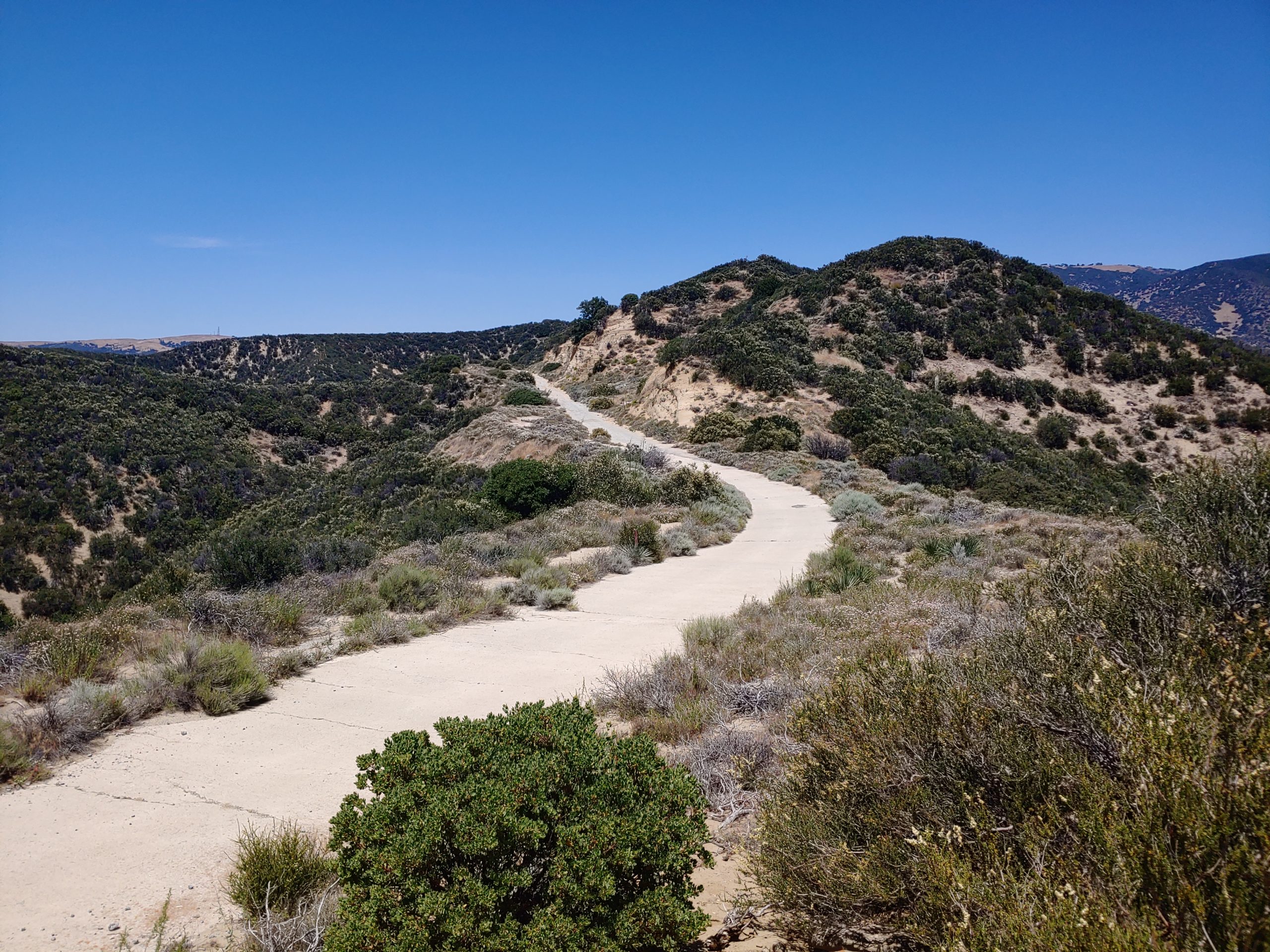
In late June, a group of board members took a trip over the Ridge Route from Castaic to Gorman to assess the roadway. To be honest, there was a lot of good news along the roadway to be had. Since the last of the major winter storms have passed, it looks like the roadway has not suffered any major damage. Most of the roadway, with little exception, was easily traversable by a standard automobile. Some sections needed a bit more maneuvering but were still quite manageable.
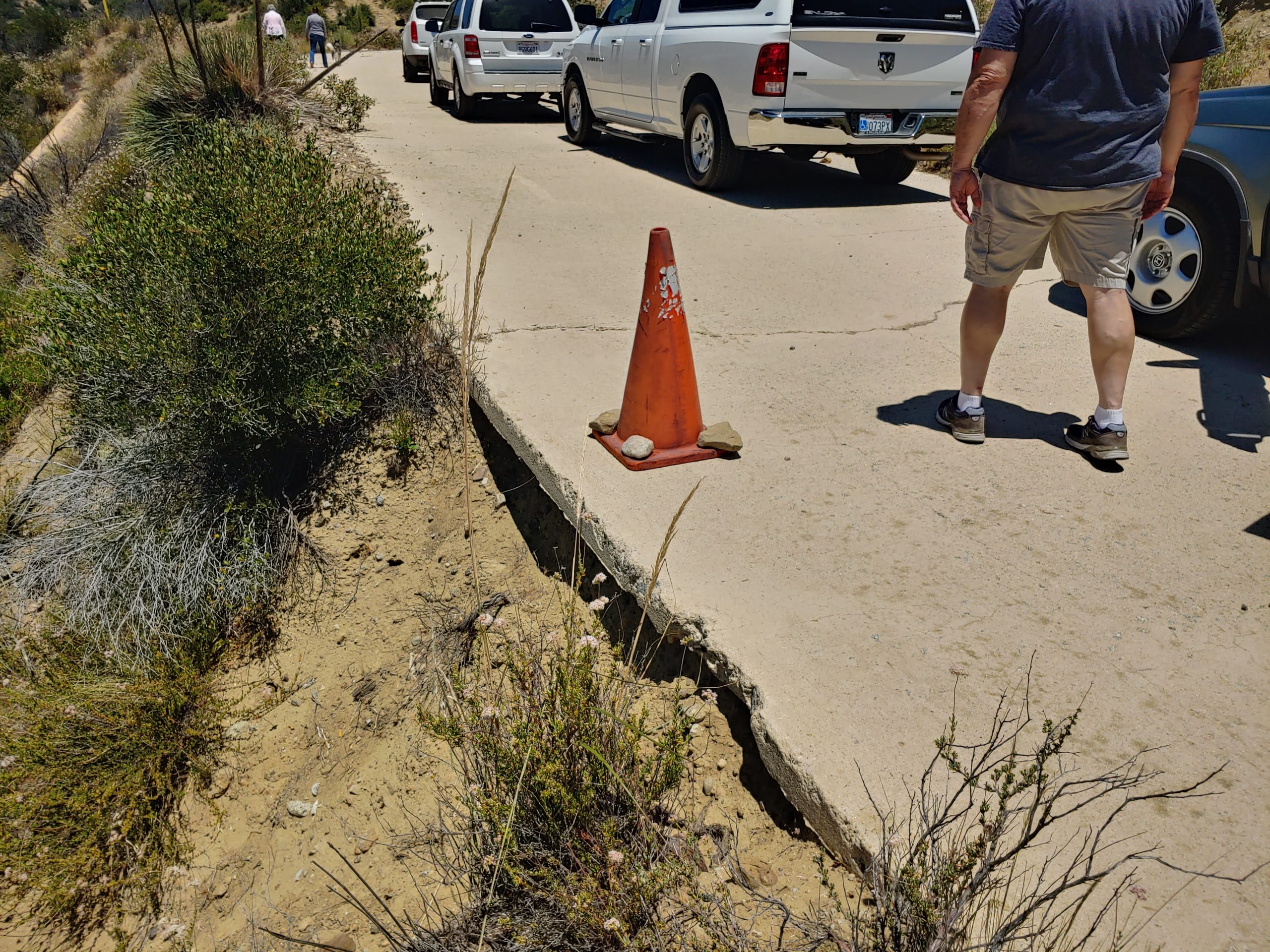
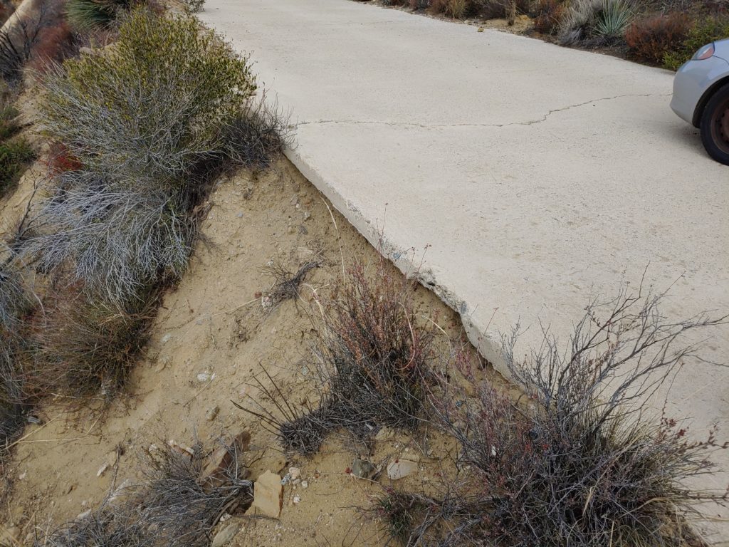
Section being undermined by a natural gas line on the slope below.
The date for our next CUTRR event is still unknown. We are presently waiting for the USFS to give us the green light for volunteer events. As it stands, August is likely out for sure. We hope to have something done before the rains begin, but we shall see.
Other ongoing projects include getting the roadway opened, replacing the signage at the markers, and setting up a YouTube channel are progressing, just slowly. The markers won’t be replaced until the roadway is opened. Funding for opening and maintaining the roadway is still unknown at present. The current crisis, health and budgetary, may well impact this more than we’d like. I feel it only delays it. We will push for legislation to force the roadway to be opened if need be.
The gates are still closed and locked. If you find a gate open, do not expect the other to be open. Travel is still restricted to non-motorized travel beyond the gates.
Due to the ongoing crisis, our events are on hold. We will resume our Clean Up The Ridge Route (CUTRR) events once things settle down. Hopefully, we can have one before the summer heat arrives. Our Ridge Route inspections will still continue unless there are further developments.
The Ridge Route itself is another issue. While the gates can be open on occasion for various reasons, the roadway is still officially closed. Once the roadway is officially open, we will make an announcement here, in addition to whatever the USFS does. As this is still the rainy season, please keep off the roadway during and after a rain storm. The roadway is fragile in places and driving it when the soils are wet can damage the roadway.
Thank you all for your continued support. We look forward to seeing you out there when we are able to hold an event again.
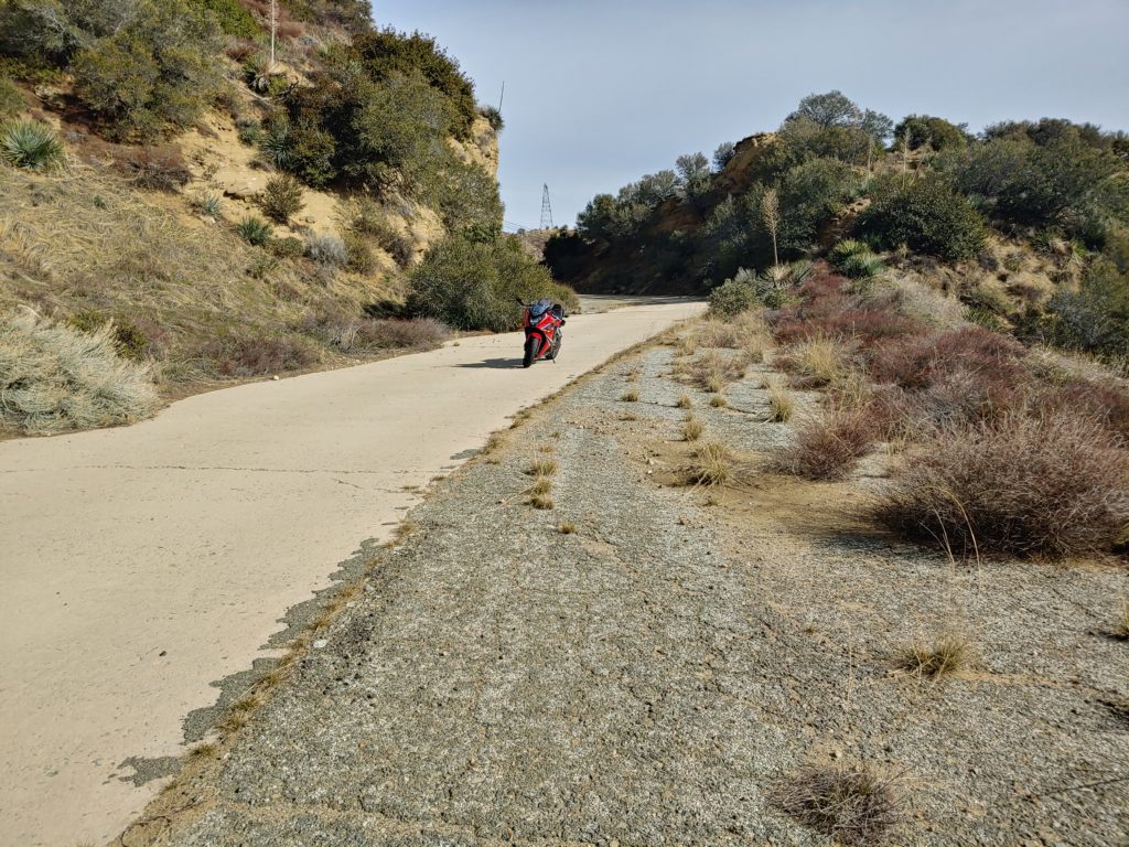
It has been an interesting time on the Ridge Route. So far, the monthly trips on the road have been quite productive. Over the weekend of January 18-19, I took a couple of trips up to the Ridge Route. On Saturday, I went by myself and took my motorcycle over the road as far as Reservoir Summit. It felt good to be back up on the Ridge. I used to spend many days up there just getting away from things. The road is quite peaceful and relaxing. Being able to stop anywhere to take photos was also nice. Few roadways of this caliber allow for this sort of privilege. Visibility was also good that day, which made for some nice photography.
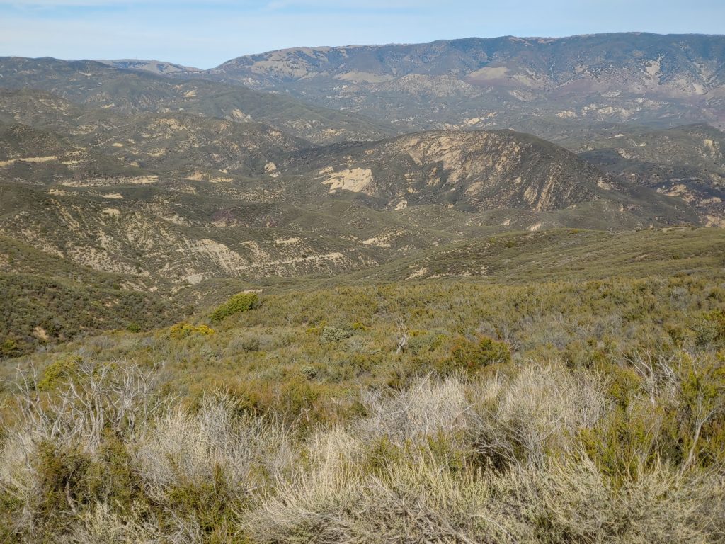
View from just south of the National Forest Inn, looking toward Reservoir Summit and Liebre Mountain.On the south grade of Reservoir Hill.
Sunday, I took another trip over the road from Castaic to Gorman with a friend. We took his car which, despite some clearance issues, made it over the road with little problem. I hope that, in light of these trips demonstrating the ability for various vehicles to traverse the roadway, that the USFS will open the roadway sooner than later.
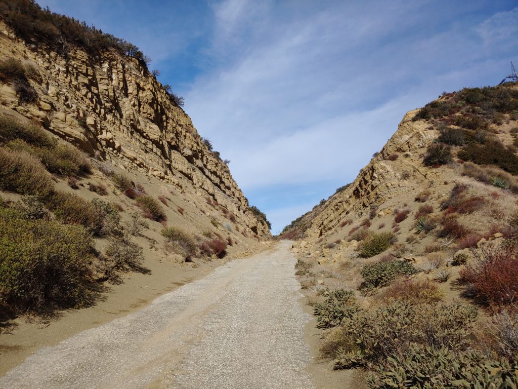
Swede’s Cut, still holding up well after some of the work that RRPO did last December.
I was pleased to see that the road was holding up well, within the gates. I did find a few more culverts that were in need of clearing near the site of the largest 2005 landslide. Those will be dealt with later this year. Outside of the gates, particularly on the northern end between the Liebre Maintenance Station and Sandberg is a real mess to say the least. Some of the sections can be easily dealt with using a broom and a shovel. The parts that are more heavily damaged will be a lot tougher to deal with. Those sections, comprised of the 1920’s asphalt, are disintegrating and are in need of new asphalt to hold things together. We will be talking to the Forest Service on ways to do this.
Section near the bottom of the south grade of Reservoir Hill that is being undermined. This is likely by pipeline work, which will need to be remedied as soon as possible.