What is the Historic Ridge Route?
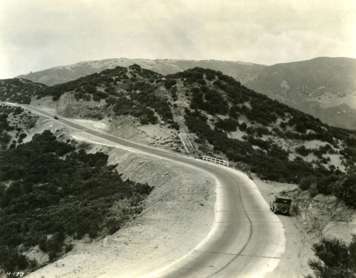
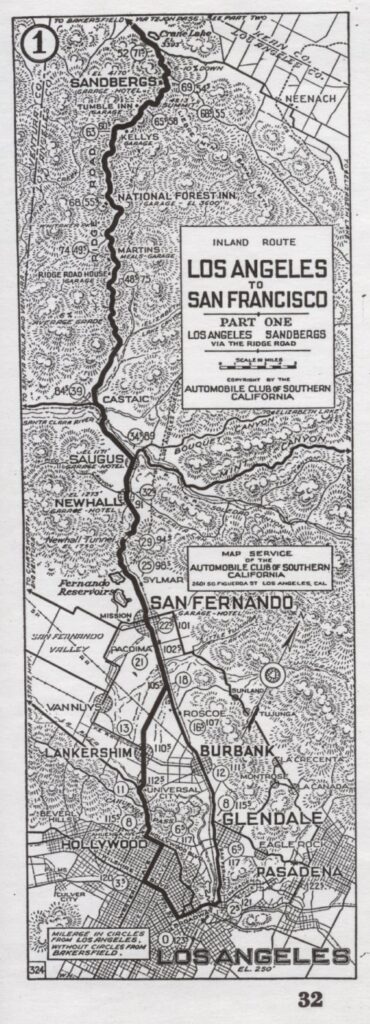
One of the first roads to be constructed under the 1909 Highway Bonds by the State of California was the “Castaic-Tejon Ridge Road”, known today as the “Ridge Route”. Hailed as a marvel of engineering in its time, it would last as the main road from Los Angeles to Bakersfield for 18 years. The roadway exists today in segments and is in part federally protected on the National Register of Historic Places. The Ridge Route was the first major highway project and first new mountain road project undertaken by the State.
Support the restoration of the Old Ridge Route – Become a member!
Surveys began for the Ridge Route in 1912, mostly following a ridge line which ran from Castaic to Gorman. Construction commenced shortly after. Using mostly manual labor, consisting of picks, shovels, and Fresno scrapers, the highway was opened in October 1915. At first, the highway was only oiled and graded. Starting in late 1917, the highway was closed while it paved with a 20′ wide slab of reinforced concrete. Paving was completed by early 1920.
As there was only a finite amount of money for the project, this route was used to keep costs down. Following the ridge kept costs down as no bridges were needed. Keeping costs down did have its problems though. The maximum grade allowed on the Ridge Route was 6%. To keep this gradient, many curves were added to the roadway. So many curves had to be used, in fact, that the total curvature added to over 110 complete circles in the 30 mile stretch. This fact would quickly make the highway a very dangerous and slow one. Collisions became commonplace. A speed limit of 15 mph was put into place along the entire road from Castaic to Gorman as a result of this.
Many sections of the road needed to be realigned for safety. Many of the cuts were “daylighted”, a process in which the hillside is cut back to increase visibility. In other places, the roadway was widened where it was possible. These realigned sections were paved with an early version of asphalt paving. Much of these early paving surfaces are still around today. By the late 1920’s, it was evident that this work was only a temporary measure. A new route had to be found. This option was both more economical and less disrupting to traffic. The new route, called the Ridge Route Alternate, was finally opened on October 29, 1933, completely bypassing the old Ridge Route. On October 2, 1934, the Ridge Route was officially relinquished to the County of Los Angeles by the Division of Highways. This bypass forever relegated the old road to a scenic side road traveled by few. In doing so, the Ridge Route was effectively preserved, almost like a time capsule, unlike any other roadway in the region.
On September 25, 1997, the Ridge Route from just north of Templin Highway to Sandberg, within the Angeles National Forest, was granted historic status on the National Register of Historic Places. This designation has helped with the preservation and restoration of this historic roadway, Under the ownership of the Angeles National Forest, the roadway is also known as 8N04, its forest road designation.
The “Grapevine” is the 6 1/2 mile segment of the Ridge Route that extends from Fort Tejon to the bottom of Grapevine Grade. Many people erroneously believe that the “Grapevine” got its name because the original 1915 highway had a series of “switchbacks” which allowed early vehicles to gain elevation as they climbed the grade heading from Bakersfield toward Los Angeles. The serpentine path resembled a giant grapevine. Although this observation was true, the name actually came from the fact that early Wagoner’s had to hack their way through thick patches of Cimarron grapevines that inhabited “La Canada de Las Uvas,” Canyon of the Grapes. Traveling the grade today, look for patches of what appears to be ivy on both sides of the canyon near the truck runaway escape ramps. What you see are descendant vines which date back to the 1800’s.
The news media incorrectly refers to the entire Ridge Route as the Grapevine.
There have been (3) Ridge Route highways. The 1915 highway which is our focus; the 1933 three-lane Ridge Route Alternate Highway identified as US 99 (converted to a 4-lane expressway between 1943 and 1951); and today’s 8-lane I-5 freeway completed in 1970. The Ridge Route Alternate was severed with the construction of Pyramid Dam.
Stories on Ridge Route’s History:
- Drive the High Country
By Paul Lasley of Westways Magazine
Relive history on California’s Original Ridge Route - Touring the Ridge Route a journey into the past
by Janet Van Vleet of The Bakersfield Californian - Small museum looms large in pioneer history
by Janet Van Vleet of The Bakersfield Californian
Tucked into a single room at the end of a strip mall, The Ridge Route Communities Museum & Historical Society might just get overlooked by most people. - “Ridge Route’s Scholar”
by Bob Pool of the Los Angeles Times.
Contains a detailed description of The Ridge Route’s history. - “The long and winding road”
by Andy Kehe of the Bakersfield Californian.
Brief history of Ridge Route and a profile of Harrison Scott. - “The Long Road to Preservation”
by Harrison Irving Scott for the Californian Historian.
Gives a brief description of Scott’s first encounter with the historic Ridge Route.


